Afghanite for Afghanistan's Infrastructures and Extractives
Survey and Topographic Services
Posted in: September 18, 2019
Survey and Topographic Services
A. Mine Site Survey
1- High resolution topographic survey
2- Trench survey
3- Hydro-graphic survey
B. Road Survey
1. Primary Route alignment survey
2. Grading plan & cut and fill
3. Layout of center-line
4. Bridges and Culverts calculation layout
C. Pipeline Survey
1. Topographic Survey
2. Alignment survey
3. Layout survey
4. Drainage Survey
D. Construction survey
1. Topographic survey
2. Divisions survey mapping
3. Subdivisions Survey
4. Cut and Fill plan and mapping
5. Grading checking of Master mapping plan
6. Mapping and parcel
7. Layout of master plan
8. Mapping and parcel
9. Layout of master plan
E. Electronic Power Survey
1. Topographic Survey
2. Cable route survey
3. Cable layout survey


Posted in: September 18, 2019
- Feasibility Study of Infrastructure Projects (Roads, Dams and Streams, Towns, …)
- Geo Technical Investigation Planning
- Geo Technical Drilling in the Project Area
- Soil Mechanics, Rock Mechanics, Concrete, Cement, Bitumen and Asphalt Laboratory /Field Testing
- Data Analyze and Geo Technical Report Preparation
- Different Soil Improvement Method Implementation (Piling , Mircopiling, Nailing , Geosyntheticsand Grouting )
- Slope and Underground Excavation Stability Study and Support Method Suggestions
- Pile and Plate Load Test


Posted in: September 18, 2019
- Interpretation of Geo Physical Data
- Radiometric Exploration
- Geo-Electrical survey
- Magnetic Exploration
- Seismic Exploration


Posted in: September 18, 2019
- Hand Specimen Study
- Provide the Thin Sections Slide by Standard Equipment for Study Under Microscope (25.4 Mm *76.2 Mm)
- Provide the Polished Sections of Ore Minerals by Standard Equipment for Study Under Microscopy (30 Mm Diameter )
- Section Study with Transmitted and Reflected Light Microscope


Posted in: September 18, 2019
- Comprehensive Geological Desk Study
- Field Visits
- Preparation of Geological Reports
- Preparing High Resolution Geological Map
- Geological Structure Analysis
- Core Logging
- Petrological Study
- Satellite Imagery Interpretation
- GIS Based Mapping and Reporting
- Geological Information and Data Interpret and Analysis
- Geological Sections Provision According to Geological Maps
- Consulting Services in the Area of Specialization


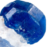
"AFGHANITE"
is the name of this mineral which was found in 1968 in Badakhshan/Afghanistan.